 |
Untitled
Untitled
Untitled
Trophey Ridge
Trophey Ridge, OK, Land For Sale
|
Featured Item:
|
20 Acres
Sunset Ranches. TERMS
$289/Month
|
|
Sunset Ranches
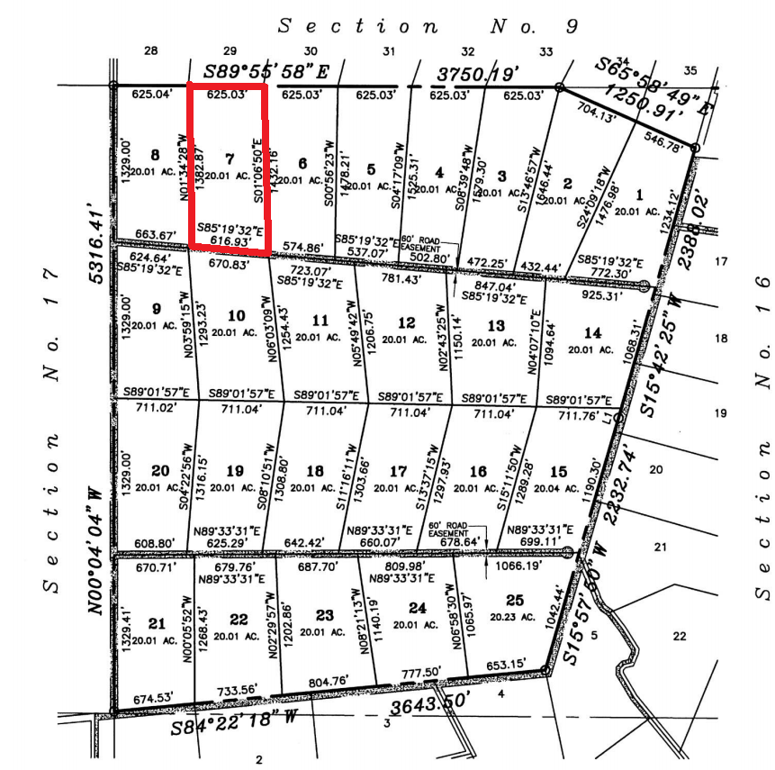
Unit 538
Lot 7
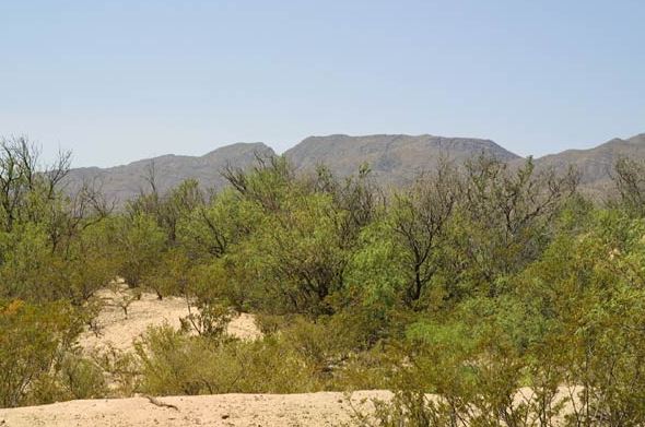
Hunters, campers and log cabins
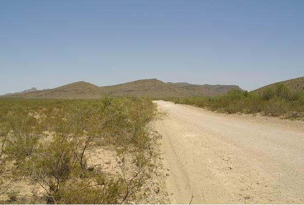
welcome. Great investment. 20 Acres, surveyed, with an
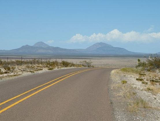
excellent road directly to the lot. Beautiful mountain
views. Gorgeous blue skies. Awesome sunsets.
This lot is being
offered for sale with financing. Simply make the small down payment,
and the land contracts will be mailed to you
immediately. You can start using or building your land while you are
making payments.
|
|
SALES PRICE: $28,998
DOWN PAYMENT: $121
MONTHLY PAYMENT: $289
INTEREST RATE: 9%
10% DISCOUNT ON
REMAINING BALANCE IF PAID EARLY
|
|
|
|
|
|
|
|
|
|
|
|
|
|
|
Location
and Legal
Description
|

Sunset Ranches
Unit: 538
Lot: 7
|
|
LOCATION:
|
Sunset Ranches is conveniently located
12 miles from Interstate 10, off paved Highway #1111, in
Hudspeth county, Texas. This scenic ranch is
approximately 10 min. from Sierra Blanca, 30 min. from
Van Horn and approximately 1 hour from El Paso (a major city).
|
|
LAND USE:
|
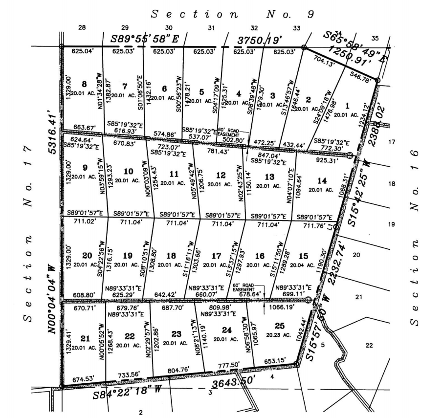
The property has been subdivided, surveyed and platted
into 20 acre lots. The buyer may IMMEDIATELY USE the LAND as a
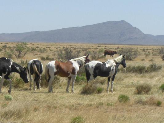
home-site, or for recreational uses such as camping, hiking,
horses or R/V's.
|
|
CLIMATE / ELEVATION:
|
The sun shines more than 300 days per
year at the subdivision. Low humidity and moderate rainfall combined with
warm temperatures create a year-round climate unlike
anywhere else. The average summer temperature is 80°. The average winter temperature is 50°. The elevation range
is 4,600 - 5,200 feet above sea level.
|
|
SERVICES:
|
Police and fire emergency services are
provided by Hudspeth county. Telephone & internet services
are also available. The nearby cities of Sierra Blanca,
Dell City, Van Horn and EI Paso all have post offices,
lodging, food, auto fuel, schools, medical facilities,
shopping and entertainment.
|
|
TOPOGRAPHY:
|
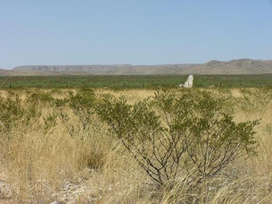
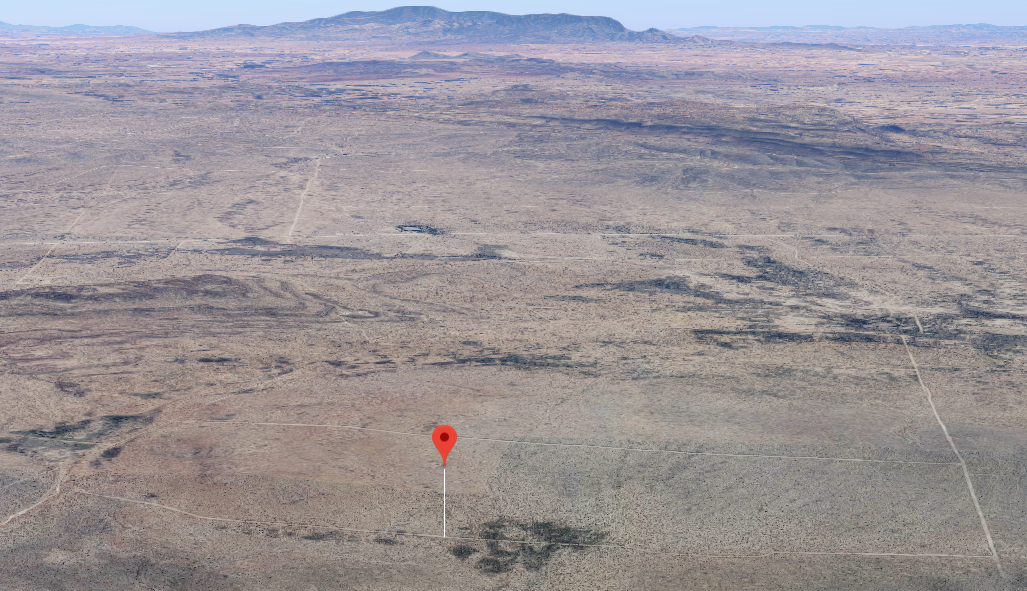
The topography of the area consists of
gently rolling hills. The plant life includes mesquite trees,
many colorful plants and beautiful native flowers.
|
|
WATER:
|
Buyer has water rights. Water can be
obtained by drilling a water well on your land. Or, you
can purchase water from a local water hauler in
combination with storage tanks that you would provide.
|
|
POWER / WASTE:
|
Power options may be obtained by the
use of propane gas generators, solar and wind power.
Waste disposal is achieved by individual septic systems.
Utility easements have been established throughout the
ranch to allow for future extension of electricity along
the lot boundaries. Power/waste costs are the
responsibility of buyer.
|
|
ROADS:
|
Dirt roads have been built and
maintained allowing access to all properties.
Seller has no obligation to pave
any of the roads.
|
|
LIVESTOCK:
|
If using the land for livestock, buyer
agrees to build a standard cattle fence around any area
of the property that contains livestock.
|
|
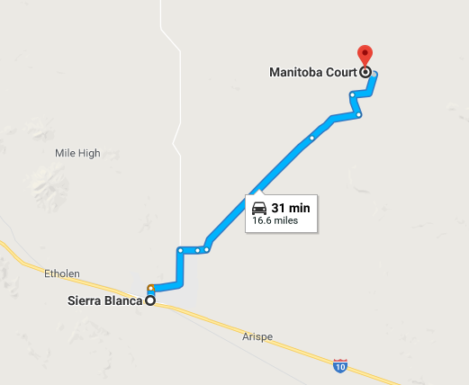
Several excellent roads to choose from to get
to the lot.
|
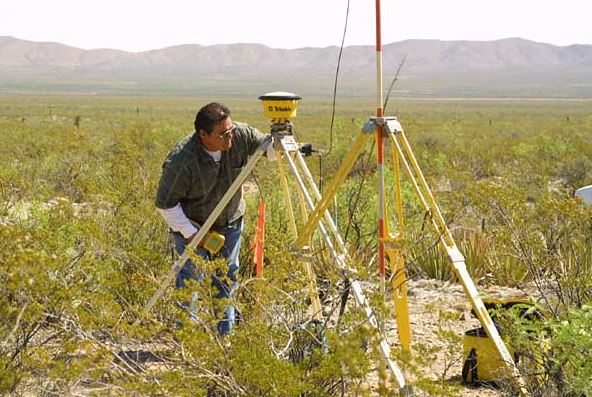
Each lot has been surveyed.
|
  
|
|
INVEST or RESELL!
|
|
State
|
Texas
|
County
|
Hudspeth
|
|
Size
|
20 Acres
|
Taxes
|
Less than $10 per Acre,
Per Year
|
HUDSPETH COUNTY
 Hudspeth
County, in the Trans-Pecos region of far-western Texas, is
bordered by New Mexico to the north, the Mexican state of
Chihuahua to the south, El Paso County to the west, and
Culberson and Jeff Davis counties to the east. Sierra
Blanca, the county seat, is seventy miles southeast of El
Paso in south central Hudspeth County. The county's center
lies at approximately 31°32' north latitude and 105°28' west
longitude, about twenty-four miles northwest of Sierra
Blanca. Interstate Highway 10 and U.S. Highway 80 cross
southern Hudspeth County from east to west, and U.S.
highways 62 and 180 cross northern Hudspeth County from east
to west. The Missouri Pacific and Southern Pacific railroads
both enter southeastern Hudspeth County and meet at Sierra
Blanca, from which point the latter line continues west to
El Paso. The county covers 4,566 square miles of terrain in
the Rio Grande basin that varies from mountainous to nearly
level, with elevations ranging from 3,200 to 7,500 feet
above sea level. Soils in the lower elevations are alkaline
and loamy with clayey subsoils that overlie limestone in
some areas; thin and stony soils predominate in the
mountains, and along the Rio Grande clay and sandy loams
predominate. Vegetation includes short, sparse grasses,
creosote bush, scrub brush, mesquite, and cacti, with
juniper, live oak, and piñon at the higher elevations. Among
the minerals found in Hudspeth County are barite, beryllium,
coal, copper, fluorspar, gold, gypsum, lead, limestone,
mica, clay, salt, silver, talc, and zinc. The climate is
subtropical, arid, warm, and dry, with an average minimum
temperature of 29° in January and an average high
temperature of 94° in July. The growing season averages 230
days a year, and the average annual precipitation is less
than ten inches. Less than 1 percent of the land in Hudspeth
County is considered prime farmland. Hudspeth
County, in the Trans-Pecos region of far-western Texas, is
bordered by New Mexico to the north, the Mexican state of
Chihuahua to the south, El Paso County to the west, and
Culberson and Jeff Davis counties to the east. Sierra
Blanca, the county seat, is seventy miles southeast of El
Paso in south central Hudspeth County. The county's center
lies at approximately 31°32' north latitude and 105°28' west
longitude, about twenty-four miles northwest of Sierra
Blanca. Interstate Highway 10 and U.S. Highway 80 cross
southern Hudspeth County from east to west, and U.S.
highways 62 and 180 cross northern Hudspeth County from east
to west. The Missouri Pacific and Southern Pacific railroads
both enter southeastern Hudspeth County and meet at Sierra
Blanca, from which point the latter line continues west to
El Paso. The county covers 4,566 square miles of terrain in
the Rio Grande basin that varies from mountainous to nearly
level, with elevations ranging from 3,200 to 7,500 feet
above sea level. Soils in the lower elevations are alkaline
and loamy with clayey subsoils that overlie limestone in
some areas; thin and stony soils predominate in the
mountains, and along the Rio Grande clay and sandy loams
predominate. Vegetation includes short, sparse grasses,
creosote bush, scrub brush, mesquite, and cacti, with
juniper, live oak, and piñon at the higher elevations. Among
the minerals found in Hudspeth County are barite, beryllium,
coal, copper, fluorspar, gold, gypsum, lead, limestone,
mica, clay, salt, silver, talc, and zinc. The climate is
subtropical, arid, warm, and dry, with an average minimum
temperature of 29° in January and an average high
temperature of 94° in July. The growing season averages 230
days a year, and the average annual precipitation is less
than ten inches. Less than 1 percent of the land in Hudspeth
County is considered prime farmland.
|
|

Never Alone Land Loan
As a financed customer, you will have a safe and convenient way to
service your loan account.
> View online statements
> View
payment history
> View contracts
> View property taxes
> View property information
LOGIN or,
contact customer service via
phone
or email.
You are never alone with an Online Land Sales
Land Loan.
|
|
|
 |