 |
 |
 |
|
Deep Fork Ranch
7.69 Acres Deep Fork Ranch, Okfuskee County, Oklahoma. TERMS $444/Month
LOT 19
Financing:
This lot is being offered for sale with financing. Simply make the small down payment, and the land contracts will be emailed and hard copy mailed to you immediately. You can start using or building your land while you are making payments.
Down Payment: $121
Monthly Payments: $444
Sales Price: $44,495
Interest Rate: 9%
10% DISCOUNT ON REMAINING BALANCE IF PAID EARLY
Checkout:
The checkout above bills the down payment only.
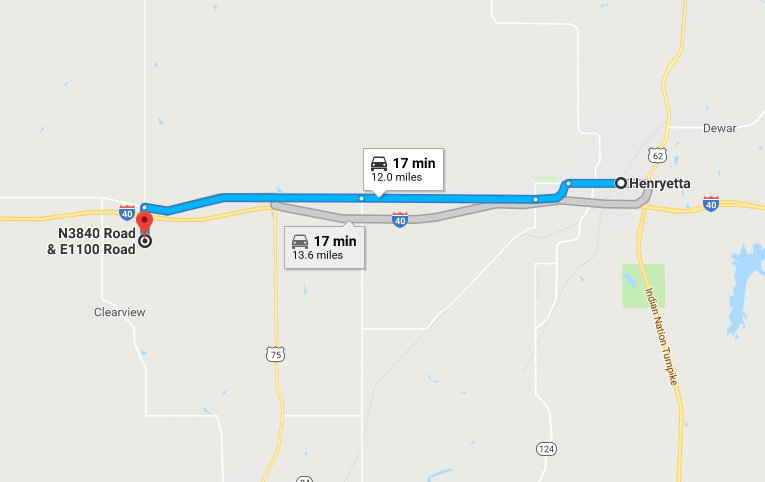
Location and Legal Description
Lot 19, Deep Fork Ranch, Okfuskee County, Oklahoma
7.69 Acres
The unspoiled land, clean air, and mild climate make Deep Fork Ranch a true landowner's dream. And our no-hassle, 100% financing make this the perfect opportunity for you to own a piece of the beautiful state of Oklahoma.
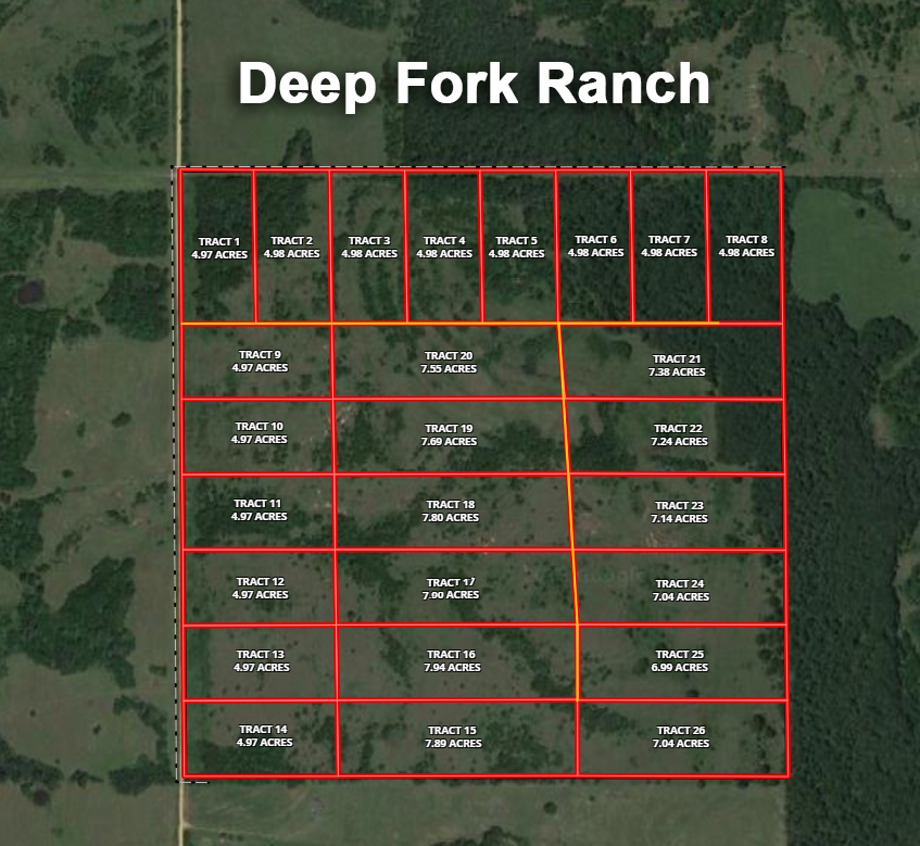
Available Lots Remaining in Deep Fork Ranch
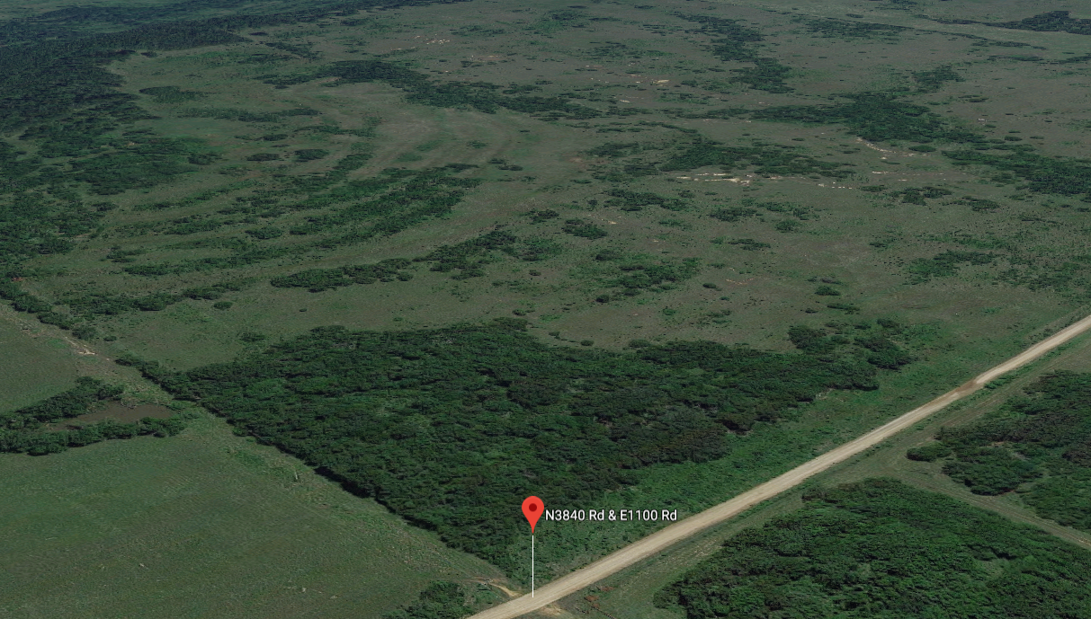
View From Old Hwy 62 Okemah, Oklahoma
TAXES: Less than $10 per year, per acre and are current.
ZONING:Residential/Agricultural
Elevation: average is approximately 682 feet.
County maintained dirt road access and paved county road frontage
Okfuskee County, Oklahoma

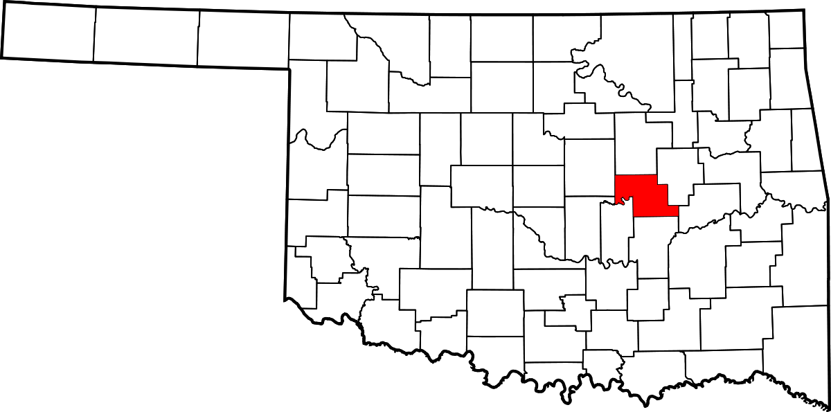 Oklahoma, Okfuskee County
Okfuskee County is a county located in the U.S. state of Oklahoma. As of the 2010 census, the population was 12,191. Its county seat is Okemah. The county is named for a former Muscogee town in present Cleburne County, Alabama, that in turn was named for the Okfuskee, a Muscogee tribe.
According to the U.S. Census Bureau, the county has a total area of 629 square miles (1,630 km2), of which 619 square miles (1,600 km2) is land and 10 square miles (26 km2) (1.6%) is water. The county lies within the Sandstone Hills physiographic region. The northeastern part is drained by the Deep Fork of the Canadian River, while the southern part is drained by the North Canadian River.
|
|
|
 |
|
 |
|