 |
 |
 |
|
X
Untitled 3
|
Featured Item:
|
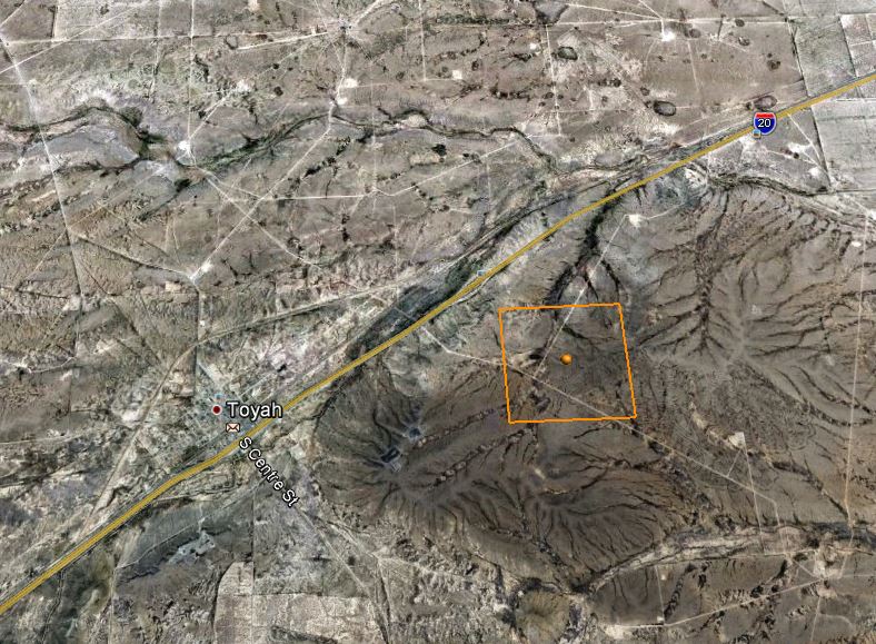
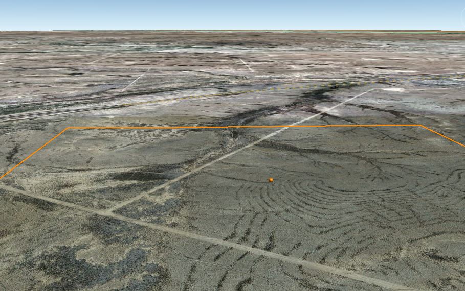
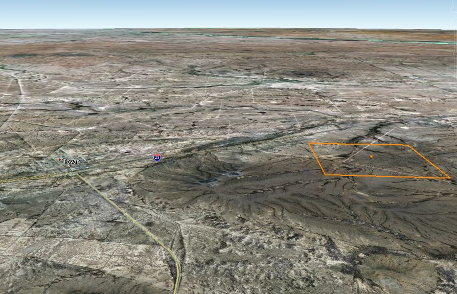
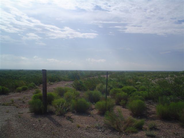
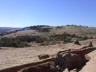
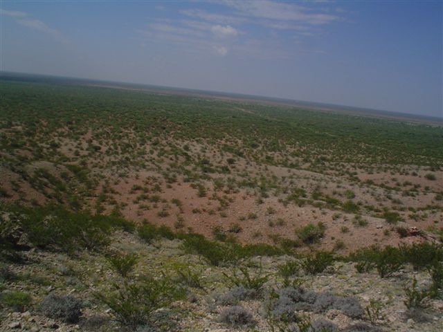
9.92 Acres, Near Pecos, Reeves County, TX. TERMS: $100/Month |
View Larger Map |
Tract: 27 AB 1723 BLK C-8 SE 27
SALES PRICE: $8,000
DOWN PAYMENT: $121
MONTHLY PAYMENT: $100
INTEREST: 9%
10% DISCOUNT ON REMAINING BALANCE IF PAID
EARLY
|
|
Checkout:
The checkout above bills the down payment of $121 only.
|
Financing:
This lot is being offered for sale with financing. Simply make the small
down payment, and the land contracts and coupon books will be emailed
and hard copy mailed to you immediately. You can start using or building
your land while you are making payments. |
|
|
 |
 |
 |
|
|


|
|
Location
and Legal
Description
|
Blk: C-8 Tract: 27 AB 1723 BLK C-8 SEC 27PSL
SE/PT SOUTH OF SALT DRAW
31.3195435, -103.7456590
|
|
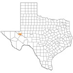
State |
Texas |
County |
Reeves |
|
 
 |
|
INVEST or RESELL! |
|
Size |
9.92 Acres
|
Taxes |
Taxes Total Less Than $100 Per
Year |
|
Utility Infrastructure |
Rural
|
Time Limit to Build |
None |
|
Information
|
 Parks and Recreation: Toyah Creek, Barrilla Mountain, Toyah Lake,
Balmorhea State Recreation Area, The Pecos River Parks and Recreation: Toyah Creek, Barrilla Mountain, Toyah Lake,
Balmorhea State Recreation Area, The Pecos River
Toyah Creek:
Toyah Creek rises in northeastern Jeff Davis County three miles
west of the Reeves county line (at 3056' N, 10340' W) and runs
northeast for fifty miles to its mouth on the Pecos River, in north
central Reeves County (at 3125' N, 10320' W). It runs through Toyah
Lake, a playa, eight miles west of the Pecos. Sandia Creek joins Toyah
2 miles east of Pecos Valley Southern Railway in north central Reeves
County.
Barrilla Mountain:
Barrilla Mountain, a summit in the Barrilla range also known as
Flat Top Mountain, is in the southeastern corner of Reeves County (at
3047' N, 10337' W). With an elevation of 4,672 feet above sea level,
Barrilla Mountain is the highest peak in Reeves County and rises 555
feet above the adjacent canyon land. The surrounding flat terrain and
rugged canyon land of desert mountain volcanic rock is surfaced by
wash deposits of sand, gravel, and mud that support live oak, pion,
juniper, grasses, maple, ponderosa pine, madrone, and water-tolerant
hardwoods and conifers.
Toyah Lake:
Toyah Lake, a playa, is on either side of U.S. Highway 285 four
miles southeast of Blue Goose Hill in northeastern Reeves County
(centered at 3122' N, 10323' W). The lake is surrounded by flat to
gently sloping desert terrain of calchefied bedrock, alluvial deposits
of sand and gravel, and windblown sand. Reddish-brown to brown sands,
clay loams and clays, and rough stony ground support scrub brush and
grasses. Toyah Lake, covering an area of 5 miles in length and 2 miles
in width, is the largest of many playas in Reeves County. Like other
playas, it gives evidence of undeveloped drainage in the area. It is
fed by two immature stream beds-Salt Draw from the west and Toyah
Creek from the east.
Balmorhea State Recreation Area:
Balmorhea State Recreation Area is located at Toyahvale, at the
northern entrance to the Davis Mountains on U.S. Highway 290 in
southeastern Reeves County. The park, including its large rock-walled
swimming pool, was built around San Solomon Springs by the Civilian
Conservation Corps in 1933. The springs, which have been called
Mescalero and Head Springs at various times, issue from caverns in the
bottom of the swimming pool. The pool covers one and three-quarters
acres, is thirty feet deep in places, and has aquatic plants and fish
living in its 76-degree water. Before 1933, 950 acres for the park was
deeded to the state by private owners and by Reeves County Water
Improvement District No. 1. In the 1940s the state legally lost all of
the land except the present forty-eight acres.
The Pecos River:
The Pecos River, one of the major tributaries of the Rio
Grande, rises on the western slope of the Santa Fe mountain range in
Mora County, New Mexico (at 3559' N, 10533' W), and runs south through
San Miguel, Guadalupe, De Baca, Chaves, and Eddy counties in New
Mexico before it enters Texas just east of the 104th meridian. In
Texas the river flows southeast, forming the boundary between Loving
and Reeves, Reeves and Ward, Ward and Pecos, Pecos and Crane, Pecos
and Crockett, and Crockett and Terrell counties. It then enters Val
Verde County at its northwestern corner and angles across that county
to its mouth (at 2942' N, 10122' W) on the Rio Grande in the Amistad
Reservoir, between Comstock and Langtry some thirty-eight miles
northwest of Del Rio. Through most of its more than 900-mile-long
course, the Pecos River parallels the Rio Grande. The total drainage
area of the Pecos in New Mexico and Texas is about 44,000 square
miles. The topography of the river valley ranges from mountain
pastures in the north, with an elevation of more than 13,000 feet
above sea level, to grasslands, semiarid irrigated farmlands, desert
with sparse vegetation, and, in the lowermost reaches of the river,
deep canyons. The principal cities along the river in New Mexico are
Las Vegas, Santa Rosa, Fort Sumner, Roswell, Artesia, and Carlsbad; in
Texas, the main city on the river is Pecos, the Reeves county seat. In
the early 1990s none of these places had a population of more than
40,000. Oil is produced in the eastern portion of the Pecos river
valley, part of the Permian basin, and sulfur and potash are also
important products. |
|

Never Alone Land Loan
As a financed customer, you will have a safe and convenient way to
service your loan account.
> View online statements
> View
payment history
> View contracts
> View property taxes
> View property information
LOGIN or,
contact customer service via phone
or email. You are never alone with an Online Land Sales Land
Loan.
|
|
|
|
|
|
|
 |
|
 |
|